
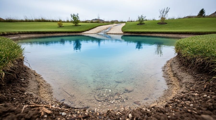
What Is the Soil and Water Assessment Tool (SWAT)? How It Works for Pond Planning
The Soil and Water Assessment Tool (SWAT) is professional-grade watershed modeling software used by scientists to predict how water, sediment, and nutrients move across a landscape. While you won’t need to run the actual software for your backyard pond project, the core principles behind SWAT can transform how you evaluate your site and prevent common pond failures before you dig the first shovelful of dirt.
Here’s what matters for pond builders: SWAT models teach us that successful water features depend on understanding your watershed (even if it’s just your yard), soil permeability, slope, and how runoff behaves during storms. A pond placed without considering these factors often struggles with murky water, erosion, or worse, complete failure during heavy rain.
The good news? You can apply SWAT’s scientific approach using simple DIY assessment methods. No computer models required. By walking your property with a spade, observing where water naturally flows after a rainstorm, and conducting basic soil tests, you’ll gather the same critical data that watershed scientists use. You’ll identify the ideal pond location, size it correctly for your drainage area, and design overflow systems that actually work.
This practical site assessment takes an afternoon but saves months of frustration. Professional watershed science isn’t just for researchers managing river basins. The same logic that protects municipal water supplies will help your pond hold water, stay clear, and survive the weather patterns typical of 2026 and beyond.
Understanding SWAT: A Watershed Model Made Simple
Think of SWAT as a weather prediction model, but for your land’s water system. Instead of tracking storms in the atmosphere, it follows every drop of rain from the moment it hits the ground, where it flows, what it picks up along the way, and where it eventually settles. Scientists originally built this tool to help farmers and watershed managers understand how their practices affect rivers and lakes downstream, tracking things like fertilizer runoff and soil erosion across huge agricultural regions.
The model breaks your landscape into puzzle pieces, analyzing each area’s slope, soil type, vegetation, and rainfall patterns. As water moves across these pieces, SWAT calculates how much soaks in, how much runs off, what sediment gets carried along, and which nutrients hitch a ride. It’s like having a detailed diary of your land’s water behavior over months or years, revealing patterns you’d never spot just by looking outside after a rainstorm.
For backyard pond builders, you don’t need the actual software or complex datasets. What matters is the thinking behind it. Your yard is a mini-watershed. Rain that falls uphill from your future pond will flow somewhere, carrying topsoil, decomposing leaves, maybe lawn fertilizer. SWAT’s principles help you ask the right questions: Where does water naturally collect? What’s washing into those low spots? How will seasonal rainfall affect water levels? By observing your property through this watershed lens, you’re applying professional hydrology concepts without needing a degree or expensive equipment.
How SWAT Principles Apply to Your Pond Site
Mapping Water Flow and Runoff
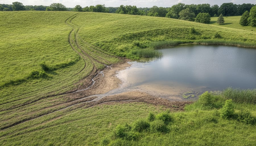
Watch where puddles form after a heavy rain, that’s your property telling you its drainage story. Before you dig, spend a few storms observing how water moves across your land. Does it sheet evenly down a gentle slope, or does it carve gullies and concentrate in low spots? Those flow paths reveal where sediment will accumulate, which areas stay saturated longest, and which slopes might funnel debris straight into your future pond.
The ideal pond site sits where runoff naturally collects without creating erosion problems upstream. A gentle depression that fills predictably beats a flat area that floods unpredictably. Walk your property during and after rain, noting where water enters, pools, and exits. Sketch these patterns on a simple site map. If runoff barrels downhill and hits your proposed pond location at speed, you’re looking at constant siltation and potential liner damage from surface erosion and sediment routing.
Mark springs, drainage swales, and wet zones on your map. A pond fed by steady groundwater seepage requires less maintenance than one relying solely on surface runoff, which carries more sediment and nutrients. Understanding these flow patterns upfront helps you position your pond where water works with you, not against you, and lets you design practical solutions, like settling basins or planted buffers, before problems start.
Identifying Erosion and Sediment Risks
Steep pond slopes accelerate erosion. Water rushing downhill picks up soil particles and dumps them straight into your pond. A gentle 3:1 grade or less slows runoff, giving sediment time to settle before reaching the water.
Your soil type determines erosion intensity. Sandy soils erode quickly but carry fine particles that cloud water temporarily. Clay soils resist erosion longer, but when they do wash in, they create stubborn turbidity that takes weeks to clear. Loam strikes a balance, though any bare soil becomes a sediment source during heavy rain.
Vegetation acts as your frontline defense. Grass roots bind soil and slow water velocity. Even a thin strip of lawn upslope from your pond traps sediment before it reaches the liner. Bare earth around the pond guarantees murky water and shortened liner life, dirt constantly rubbing against flexible liners causes premature wear and small tears.
Mark bare spots, steep grades, and areas where water concentrates during storms. These are your high-risk zones. Address them early with ground cover, mulch, or simple berms, and you’ll spend far less time battling cloudy water later.
Soil Testing and Why It Matters for Pond Hydrology
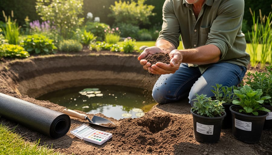
Your soil is the foundation of your pond’s hydrology, it dictates how water behaves, whether your pond will leak like a sieve or hold water beautifully, and which plants will thrive. Understanding your soil type for ponds connects directly to SWAT’s hydrology models, which track how water infiltrates, percolates, and moves through different soil layers.
Start with a simple texture test. Grab a handful of moist soil, squeeze it, and observe. Clay forms a tight, slippery ball that holds its shape, it’s the gold standard for natural ponds because it’s nearly waterproof. Sandy soil falls apart immediately and drains fast, meaning you’ll almost certainly need a liner. Loam, a mix of clay, silt, and sand, sits in the middle; it may hold water if clay content is high enough, but test thoroughly before committing.
Next, check permeability with a quick percolation test. Dig a hole about 30cm deep, fill it with water, and time how long it takes to drain. Water that disappears in under an hour signals high permeability, expect seepage without a liner. If it takes several hours or stays overnight, you’ve got low permeability, which is perfect for a natural pond bottom.
Don’t skip organic content. Squeeze your soil sample. Does it smell earthy and feel spongy? High organic matter improves water retention slightly but can cause muddiness and nutrient loading, SWAT models this as potential algae fuel. If your soil is mostly organic topsoil, plan to excavate down to mineral subsoil for the pond basin, or budget for more filtration.
These simple tests translate SWAT’s complex hydrology equations into real-world pond decisions: liner or no liner, how much seepage to expect, and whether your marginal plants will anchor properly. You’re not running software, but you’re thinking like a watershed scientist.
Conducting a DIY Site Assessment with SWAT Concepts in Mind
You don’t need expensive equipment or a degree in hydrology to assess your pond site, just patience, a notebook, and willingness to watch how water moves across your land. Start by observing your property after a good rain. Walk the site while it’s wet or within a few hours of a storm. Notice where puddles form, where water collects, and which paths it carves as it flows downhill. These are your natural drainage patterns, and they’ll tell you more about your site than any map.
Grab a few wooden stakes or bright flags and mark any spots that stay wet longer than the rest of your yard. Check these areas again a day or two later. Persistent wet zones might indicate a high water table, a spring, or clay-heavy soil that drains slowly, all critical clues for pond placement and liner decisions. If you find a natural low point that collects water, that’s often your best pond location. Gravity does the work for you.
Next, measure the slope across your potential pond area. You don’t need a surveyor’s level; a long board, a carpenter’s level, and a tape measure work fine. Lay the board on the ground, level it, then measure the gap between the downhill end and the soil. Divide that gap by the board’s length to get your slope percentage. Gentle slopes (under 5%) are ideal for natural pond steps and easy excavation. Steeper grades increase erosion risk and may require terracing or extra stabilization.
Here’s a simple sequence to document everything:
- Track at least two rain events, photographing wet spots, runoff paths, and ponding areas immediately after each storm.
- Sketch a rough site map showing your property boundaries, existing structures, trees, and marked wet zones.
- Measure and note slope at your intended pond site and along major drainage routes leading toward it.
- Dig small test pits (about a foot deep) in different areas to compare soil texture, moisture, and layering.
- Return to marked wet spots after dry spells to see if they’re seasonal or permanent water sources.
Keep all observations in one notebook or digital file with dates. Over a few weeks, patterns emerge: which areas drain fast, which hold moisture, where sediment collects. This low-tech detective work captures the same hydrology insights SWAT models at scale, water movement, soil behavior, erosion risk, tailored precisely to your backyard. You’re building a site knowledge base that guides every decision, from pond depth to plant selection.
Using SWAT Data (When Available) and Free Tools
You don’t need to run SWAT software to benefit from the data it generates. Government agencies and research institutions have already done the heavy lifting, and much of that information is freely available online.
Start with the USDA’s Web Soil Survey. Type in your address, draw a boundary around your property, and you’ll get detailed soil maps showing texture, drainage class, permeability, and depth to bedrock. The site explains what each soil type means in practical terms. Look for phrases like “somewhat poorly drained” or “moderate permeability”, these directly affect whether your pond will hold water naturally or need a liner.
Your local Natural Resources Conservation Service office often has watershed maps and hydrology reports for your area. Call or visit; staff are typically happy to help homeowners interpret data and point you toward resources. Some states offer online GIS portals where you can layer topography, soil types, floodplains, and drainage networks onto satellite imagery of your property.
For slope and drainage direction, Google Earth’s terrain view works surprisingly well. Trace where water would naturally flow during a heavy rain. This helps you avoid placing a pond where runoff will constantly dump sediment into it, or where it might inadvertently create a self-watering system that overflows during storms.
If your project involves more than a simple backyard pond, say you’re planning multiple water features, working on steep terrain, or dealing with drainage issues affecting neighbors, hiring a landscape architect or civil engineer to review the data makes sense. They can translate complex hydrology reports into specific design recommendations and help you avoid expensive mistakes.
Common Questions About SWAT and Pond Site Assessment
Most pond builders worry they’ll need specialized software or a degree in hydrology to get their project right. The truth? You can apply SWAT’s core principles, watching how water moves, understanding your soil, assessing slope, without ever opening a computer model.
Do I need SWAT software to build a successful pond?
No. SWAT is a professional tool designed for large watersheds, but you can use its principles, observing runoff, testing soil, noting drainage patterns, through simple site walks and basic tests. The concepts matter more than the software.
Can I build a pond without formal hydrology analysis?
Yes, especially for smaller backyard ponds. Pay attention to where water naturally collects after rain, check your soil’s ability to hold water, and avoid steep slopes or areas with heavy runoff. Common sense observation goes a long way.
How do I know if my soil will hold water?
Dig a test hole about two feet deep, fill it with water, and see how fast it drains. Sandy soil that empties in an hour or two will need a liner; clay-heavy soil that holds water overnight has natural sealing potential.
What if my site has poor drainage or heavy runoff?
You can work with it. Redirect excess flow with swales or berms, plant vegetation upslope to slow erosion, or design your pond to handle seasonal surges with an overflow system. Poor drainage isn’t a dealbreaker, it just requires thoughtful planning.
The goal isn’t perfection. You’re looking for enough information to make informed choices about location, size, and whether you’ll need a liner. If your property has complex water issues, multiple springs, flood-prone areas, significant erosion, consulting a local soil and water conservation district can save you headaches. But for typical backyard projects, your own observations paired with a basic soil test give you what you need to move forward confidently.
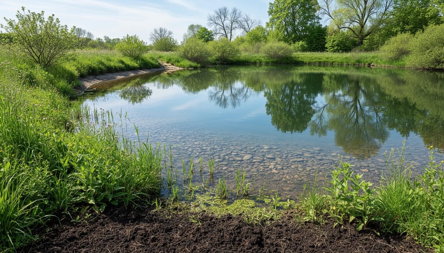
You don’t need a PhD in hydrology to build a pond that works with nature instead of fighting it. By borrowing a few ideas from watershed science, watching where water goes, testing your soil, and noticing how your land slopes, you’re already thinking like a scientist. Those simple observations give you the power to choose the right spot, avoid erosion headaches, and create clearer, healthier water from day one.
A weekend spent walking your property after a rainstorm, digging a few test holes, and sketching a rough drainage map isn’t glamorous work. But it saves you from battling algae blooms, repairing washed-out banks, and constantly topping off a leaky pond. Understanding your site’s natural rhythms means less maintenance, fewer costly fixes, and a pond ecosystem that balances itself.
The best part? You probably already have everything you need: your eyes, a shovel, a notebook, and curiosity about how water moves across your land. Start there. The ponds that last decades aren’t the ones built fastest, they’re the ones built smart, with a little patience and respect for what the land is already trying to tell you.