

LiDAR Drones Transform Pond Management: See What’s Really Going On Below the Surface
Transform your pond management with cutting-edge smart drone monitoring powered by LiDAR technology. This revolutionary approach captures precise 3D measurements of your pond’s depth, contours, and surrounding landscape with centimeter-level accuracy. LiDAR drones hover systematically above your water feature, emitting rapid laser pulses that bounce off surfaces to create detailed digital maps – even penetrating through vegetation to reveal hidden underwater features.
Unlike traditional surveying methods that take days and require pond drainage, LiDAR drone services complete comprehensive scans in hours while your pond remains fully operational. The resulting data helps identify potential trouble spots, optimize aeration placement, calculate exact water volumes, and create maintenance schedules based on real-world conditions rather than estimates.
For pond owners seeking professional-grade insights without technical complexity, LiDAR drone services deliver actionable intelligence through easy-to-understand reports and 3D visualizations. This technology has transformed from a costly industrial tool into an accessible solution for proactive pond management, helping you make informed decisions about everything from fish stocking to erosion control.
How LiDAR Drones Work in Pond Management
Understanding LiDAR Technology
Think of LiDAR as a high-tech measuring tape that uses light instead of physical measurements. When mounted on a drone, LiDAR sensors send out thousands of invisible laser pulses per second that bounce off objects and return to the sensor. By measuring how long it takes for each pulse to return, the system creates an incredibly detailed 3D map of your pond and its surroundings.
Imagine throwing thousands of ping pong balls at your pond area and recording exactly where each one lands and at what height – that’s similar to how LiDAR works, but with light beams! The resulting data creates a “point cloud” that shows every detail of your pond’s shape, depth, and surrounding landscape features.
What makes LiDAR special for pond owners is its ability to see through vegetation and work in various lighting conditions. Unlike regular photographs, LiDAR can map your pond’s bottom even through murky water and detect subtle changes in depth that might be invisible to the naked eye.
The best part? You don’t need to understand the complex technology to benefit from it. Professional drone operators handle all the technical aspects while delivering easy-to-understand maps and measurements of your pond.

Drone-Mounted LiDAR Systems
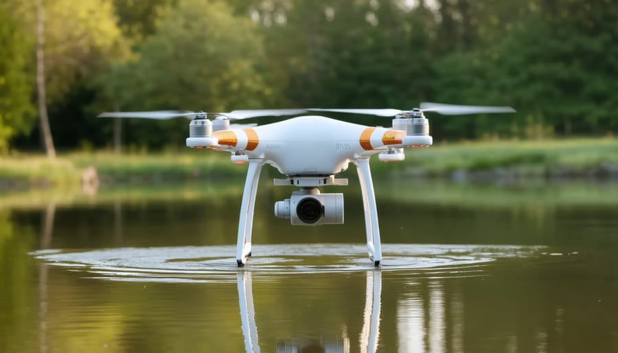
Modern LiDAR drone systems for pond monitoring typically combine lightweight, waterproof drones with specialized LiDAR sensors and GPS equipment. These systems work together with smart pond management systems to create detailed 3D maps of your pond environment.
The basic setup includes a drone platform (usually a quadcopter) equipped with a compact LiDAR sensor, which can be either integrated or mounted as an attachment. Popular choices include the DJI Matrice series or similar professional-grade drones that can handle the additional weight of LiDAR equipment while maintaining stable flight patterns.
For pond monitoring, you’ll want a system that includes waterproof features and has good battery life – typically 20-30 minutes of flight time. The LiDAR sensor should have a range of at least 50 meters and the ability to penetrate water surface to some degree. Most systems also come with a ground control station, usually a tablet or laptop, that helps you plan flight paths and collect data in real-time.
When choosing your equipment, consider starting with entry-level systems that balance functionality with cost-effectiveness. Many manufacturers offer complete kits specifically designed for water body monitoring, making it easier to get started without extensive technical knowledge.

Key Benefits for Your Pond
Accurate Depth Mapping
LiDAR technology creates incredibly detailed 3D maps of your pond by using laser pulses to measure distances. As the drone flies over your water feature, it sends out thousands of laser beams per second that bounce off the water’s surface and pond bottom. These reflections are captured by sensors, creating a precise picture of your pond’s depth profile.
Think of it as taking an underwater X-ray of your pond! The technology measures every dip, ridge, and variation in depth, giving you a complete understanding of your pond’s underwater landscape. This detailed mapping helps identify potential problem areas like sediment buildup or structural issues that might affect water flow.
What makes LiDAR particularly amazing for pond owners is its accuracy – it can detect depth changes as small as a few inches. This precise data helps you plan maintenance more effectively, whether you’re scheduling dredging work or installing new features like fountains or aerators.
The best part? These depth maps can be viewed in easy-to-understand 3D models on your computer or tablet, making it simple to track changes in your pond over time and plan improvements accordingly.
Sediment Build-up Detection
LiDAR drone services excel at detecting sediment build-up in ponds, making it easier than ever to maintain optimal water depth and quality. These advanced drones use precise laser measurements to create detailed maps of your pond’s bottom, highlighting areas where sediment has accumulated over time.
Think of it as getting a detailed x-ray of your pond’s floor. The drone flies over the water surface, sending thousands of laser pulses that penetrate the water and bounce back, creating a comprehensive 3D picture of sediment distribution. This technology can spot problem areas you might miss during regular visual inspections, such as hidden sediment banks near inflow points or uneven build-up around structures.
The real magic happens when comparing scans over time. Regular monitoring helps track sediment accumulation rates and identifies patterns in problem areas. This information is invaluable for planning maintenance schedules and preventing costly issues before they become serious. You’ll know exactly where to focus your dredging efforts and can make informed decisions about installing preventive measures like sediment traps or adjusting water flow patterns.
Vegetation Management
LiDAR drone technology has revolutionized aquatic plant management by offering precise monitoring of vegetation growth and distribution in water bodies. Using advanced sensors, drones can create detailed 3D maps of your pond’s plant life, helping you track changes over time and identify potential issues before they become problems.
These aerial surveys can detect subtle variations in plant density, height, and coverage area, making it easier to spot invasive species early or monitor the health of beneficial plants. The technology is particularly useful for larger ponds where manual inspection might be challenging or time-consuming.
The data collected helps pond owners make informed decisions about maintenance schedules, plant trimming needs, and overall ecosystem balance. You’ll receive easy-to-understand maps and reports showing where plants are thriving or struggling, which areas need attention, and how your vegetation management efforts are paying off over time.
This regular monitoring ensures your pond maintains its natural beauty while preventing unwanted plant overgrowth that could harm fish or affect water quality. It’s like having a gardener’s eye view from above, but with precise measurements and scientific accuracy.
Structural Issue Detection
LiDAR drone technology excels at detecting structural issues that might go unnoticed during routine visual inspections. Using precise laser measurements, these drones can identify subtle changes in terrain, infrastructure, and water containment systems that could indicate developing problems.
For pond owners, this means early detection of critical issues like erosion along embankments, settling or shifting of retaining walls, and potential weak points in dam structures. The technology can spot slight depressions or bulges that might signal underground leaks or soil instability before they become major problems.
The drones create detailed 3D maps that highlight areas of concern, such as uneven settlement patterns or changes in structural alignment. This data helps maintenance teams pinpoint exactly where repairs are needed, making maintenance more efficient and cost-effective.
Regular LiDAR scans can also track changes over time, allowing pond managers to monitor the progression of known issues and predict when maintenance will be required. This proactive approach helps prevent catastrophic failures and extends the life of pond structures while keeping maintenance costs under control.
Getting Started with LiDAR Drone Services
Finding the Right Service Provider
When selecting a LiDAR drone service provider for your pond maintenance solutions, it’s essential to consider several key factors to ensure you get accurate and reliable results.
First, verify the provider’s certifications and licenses. Any reputable drone operator should hold valid FAA certifications and necessary insurance coverage. Ask about their specific experience with LiDAR technology and water feature mapping – experienced operators will have a portfolio of similar projects they can share.
Check their equipment quality and capabilities. Professional-grade LiDAR drones offer better accuracy and more detailed data than basic consumer models. Ask about the resolution and accuracy of their systems, and ensure they match your needs.
Consider their data processing and delivery methods. A good provider should offer clear, usable formats for your data and be able to explain how you can access and interpret the results. They should also provide technical support and explain their findings in terms you can understand.
Don’t forget to ask about their safety protocols and emergency procedures. Reliable operators will have clear safety guidelines and contingency plans for various situations.
Finally, request detailed quotes and compare services between providers. While price shouldn’t be the only factor, understanding what’s included in the service package will help you make an informed decision. Look for providers who offer comprehensive solutions rather than just basic scanning services.
Cost Considerations
When considering LiDAR drone services for your pond monitoring needs, it’s important to understand the various cost factors involved. Typically, basic LiDAR drone surveys start around $500 for small pond areas and can range up to several thousand dollars for larger or more complex projects.
The final price depends on several key factors. First, the size of your pond area – larger spaces require more flight time and data processing. Second, the level of detail needed – higher resolution scans cost more but provide more accurate measurements. Third, the complexity of the terrain and surrounding vegetation, which can affect flight patterns and data collection time.
Most service providers offer different packages:
– Basic survey (depth mapping only): $500-$1,000
– Standard package (depth mapping + vegetation analysis): $1,000-$2,500
– Comprehensive survey (includes water quality assessment): $2,500-$5,000
While these costs might seem significant initially, consider the long-term value. LiDAR surveys can help prevent costly maintenance issues, optimize dredging operations, and provide accurate documentation for permit requirements. Many pond owners find that the precision and efficiency of LiDAR technology actually saves money compared to traditional survey methods.
To get the best value, consider:
– Booking during off-peak seasons
– Combining surveys with neighboring pond owners
– Requesting multi-year service packages for better rates
– Using the same provider for both survey and maintenance work
Remember to get multiple quotes and check if providers offer free consultations or site evaluations. Some companies also provide flexible payment plans or seasonal discounts.
Preparing Your Pond for Scanning
Before scheduling your LiDAR drone survey, proper preparation of your pond area ensures the most accurate and detailed mapping results. Start by removing any temporary items like pool floats, maintenance equipment, or decorative elements that aren’t part of the permanent landscape. These objects can create unwanted data points in your scan.
Next, trim back any overhanging vegetation that might obstruct the drone’s view of the pond edges. While LiDAR can penetrate through some foliage, clear sight lines will provide the best results. If possible, schedule your scan during the fall or winter when deciduous trees have less foliage.
Mark important features around your pond that you want to be specifically identified in the scan. This might include spillways, filtration systems, or underwater shelves. Use bright-colored markers or flags that will be visible from above but won’t interfere with the scanning process.
Consider the timing of your scan carefully. Early morning or late afternoon sessions typically offer the best conditions, with minimal wind and optimal visibility. Avoid scheduling during rainy weather or when there’s significant surface disturbance on the water, as this can affect the accuracy of depth measurements.
If your pond has any floating plants or vegetation mats, decide whether you want these included in the scan or temporarily moved. While they’re part of your pond’s ecosystem, they might affect the accuracy of bottom contour measurements.
Finally, ensure all electrical systems and fountains are turned off during the scan. Moving water features can create interference in the data collection process. Having your pond still and calm will result in the most precise mapping of your water feature.
LiDAR drone services have revolutionized the way we monitor and maintain our water features, offering unprecedented accuracy and efficiency in pond management. By combining advanced laser scanning technology with drone capabilities, pond owners now have access to detailed measurements and insights that were previously impossible or prohibitively expensive to obtain.
The value of these services extends far beyond simple depth measurements. From tracking sediment buildup to planning maintenance schedules, LiDAR technology helps pond owners make informed decisions based on precise data. This technology has proven particularly valuable for larger properties and commercial installations, where regular manual surveying would be time-consuming and costly.
Looking ahead, the future of LiDAR drone services appears incredibly promising. As technology continues to advance, we can expect to see even more accessible and affordable options becoming available to pond owners. Improvements in battery life, sensor accuracy, and data processing capabilities will likely make these services even more practical and user-friendly.
The integration of artificial intelligence and machine learning with LiDAR data analysis could soon provide predictive maintenance recommendations, helping pond owners address potential issues before they become problems. Additionally, as more pond owners adopt this technology, the collective data gathered could contribute to better understanding pond ecosystems and maintenance best practices.
Whether you’re managing a small backyard pond or overseeing multiple water features, LiDAR drone services offer a powerful tool for maintaining healthy, beautiful water gardens while saving time and resources in the long run.